
Powell River
The Powell River is a short river in British Columbia flowing from Powell Lake to the Salish Sea.
Also known as: Powell River BC
How big is it?
500 m · approximate main-channel length
Also 1,640 ft
Approximate main-channel length · approximate
Typical recorded range: 450 m to 550 m.
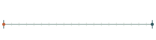
A little perspective
Powell River vs Sydney Harbour Bridge: length comparison
The main arch span of Sydney Harbour Bridge is about 1.01 times the main-channel length of the Powell River.
The Powell River is a short river in British Columbia flowing from Powell Lake to the Salish Sea.
Sydney Harbour Bridge is a steel arch bridge in Sydney, Australia, connecting the city centre with the North Shore.
Both rulers start at the same zero and share one linear scale. Artwork keeps its original proportions.
Measurements, assumptions & sources +
Powell River
Approximate main-channel length: 500 m; approximate; range 450 m–550 m.
The short Powell River in British Columbia is approximately 500 m from Powell Lake to the Salish Sea. Channel and endpoint conventions affect the result.
Natural Resources Canada — Powell River
The marked approximate main-channel length is calibrated. Unmeasured illustration details are representative.
Sydney Harbour Bridge
Main arch span: 503 m; specified; range 502 m–504 m.
The selected measurement is the approximately 503 m main steel arch span, not total approach length.
Transport for NSW — Sydney Harbour Bridge
The marked main arch span is calibrated. Unmeasured illustration details are representative.
Use the visual comparison to explore its scale, then check the measurements and sources.
Change your perspective
Put it next to…
Choose a suggestion to redraw the comparison, or open its page to learn what it is.
Why this measurement?
Why we use 500 m
We compare the main-channel length of the Powell River. This is an estimate; check the notes for its rounding and uncertainty. The recorded range is 450 m to 550 m.
The short Powell River in British Columbia is approximately 500 m from Powell Lake to the Salish Sea. Channel and endpoint conventions affect the result.
The marked horizontal span follows the measured feature, not the edges of the image. How calibrated comparisons work →
Recorded properties
Dimensions and measurements
| Property | Selected value | Recorded range | Basis |
|---|---|---|---|
| 500 m | 450 m to 550 m | approximate |
Around this scale
Explore nearby values.
Compare examples with lower, similar and higher values. Each card names the measurement being compared.
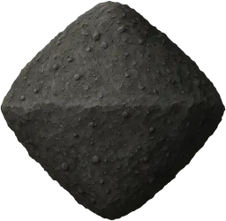 Nearest lower valuePlanets, moons and spaceBennu asteroid492 mRepresentative equatorial diameterBennu is a near-Earth asteroid with a rubble-pile structure and a roughly top-shaped body.
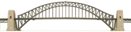 Around the same scaleBuildings and structuresSydney Harbour Bridge503 mMain arch spanSydney Harbour Bridge is a steel arch bridge in Sydney, Australia, connecting the city centre with the North Shore.Nearest higher valuePlaces and natural featuresNautley River800 mApproximate main-channel lengthThe Nautley River is a short waterway in British Columbia connecting Fraser Lake to the Nechako River.
Sources and method
Want to check the number?
The source records and measurement method remain available for inspection.
- Natural Resources Canada — Powell RiverNamed British Columbia river and endpoint context; channel length is approximate.
There’s always another scale
Follow your curiosity.
PlacesNautley River800 mThe Nautley River is a short waterway in British Columbia connecting Fraser Lake to the Nechako River.PlacesComal River4 kmThe Comal River is a natural watercourse in New Braunfels, Texas, that flows from springs to join the Guadalupe River.Built worldSydney Harbour Bridge503 mSydney Harbour Bridge is a steel arch bridge in Sydney, Australia, connecting the city centre with the North Shore.SpaceBennu asteroid492 mBennu is a near-Earth asteroid with a rubble-pile structure and a roughly top-shaped body.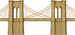 Built worldBrooklyn Bridge486.3 mThe Brooklyn Bridge is a suspension bridge spanning the East River between Manhattan and Brooklyn in New York City.Sport400 m running lap400 mA 400 m running lap is the standard distance for one circuit of an athletics track, measured along the inside lane.
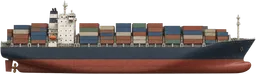 TransportContainer ship400 mA container ship is a large vessel built to transport standardised cargo containers across seas and oceans.
 Built worldCN Tower553.3 mThe CN Tower is a telecommunications and observation tower in Toronto, Canada.