Yenisei
The Yenisei is a major river in Siberia, Russia, flowing northwards from Mongolia to the Arctic Ocean.
Also known as: Yenisei River, Yenisey
How big is it?
5,539 km long
Also 3,442 mi
Approximate river-system length · approximate
Typical recorded range: 5,480 km to 5,600 km.

A little perspective
About the same scale as Ganymede.
Ganymede: Ganymede is a natural satellite of Jupiter and contains a magnetic field generated by its partially liquid core.
Measurements, assumptions & sources +
Yenisei
The Yenisei–Angara–Selenga–Ider river system is commonly listed at approximately 5,539 km. Totals depend on which headwater is selected and how the channel centreline is measured.
Encyclopaedia Britannica — Yenisey River
The marked approximate river-system length is calibrated. Unmeasured illustration details are representative.
Ganymede
Rounded mean-radius model of Ganymede. The derived area and volume describe a sphere; surface terrain and flattening are omitted.
NASA JPL — Planetary satellite physical parameters
The marked mean diameter is calibrated. Unmeasured illustration details are representative.
Change your perspective
Put it next to…
Choose a suggestion to redraw the comparison, or open its page to learn what it is.
Why this measurement?
Why we use 5,539 km
For comparison, this page uses approximate river-system length. This is labelled approximate; the central value is useful for comparison, while real values or measurement solutions can vary. The recorded range is 5,480 km to 5,600 km.
The Yenisei–Angara–Selenga–Ider river system is commonly listed at approximately 5,539 km. Totals depend on which headwater is selected and how the channel centreline is measured.
The marked horizontal span follows the named feature; transparent margins and unmeasured details do not alter it. How calibrated comparisons work →
Recorded properties
Yenisei dimensions and measurements
| Property | Selected value | Recorded range | Basis |
|---|---|---|---|
| 5,539 km | 5,480 km to 5,600 km | approximate |
Around this scale
Go smaller. Go bigger.
These links use compatible length records, ordered around the selected value.
Nearest lower value · PlacesOb–Irtysh system5,410 kmThe Ob–Irtysh system is a river network in western Siberia, Russia and Kazakhstan, formed by the Ob River and its main tributary, the Irtysh.Around the same scale · PlacesLena4,400 kmThe Lena is a major river in eastern Siberia, Russia, flowing from the Baikal Mountains to the Laptev Sea.Nearest higher value · PlacesAmazon River6,400 kmThe Amazon River is a major waterway in South America that flows eastward across the continent and drains a vast rainforest basin.Sources and method
Want to check the number?
The source records and measurement method remain available for inspection.
- Encyclopaedia Britannica — Yenisey RiverYenisei system and headwater context; the atlas uses the commonly listed 5,539 km system length.
There’s always another scale
Follow your curiosity.
PlacesLena4,400 kmThe Lena is a major river in eastern Siberia, Russia, flowing from the Baikal Mountains to the Laptev Sea.PlacesOb–Irtysh system5,410 kmThe Ob–Irtysh system is a river network in western Siberia, Russia and Kazakhstan, formed by the Ob River and its main tributary, the Irtysh.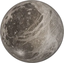 SpaceGanymede5,262 kmGanymede is a natural satellite of Jupiter and contains a magnetic field generated by its partially liquid core.
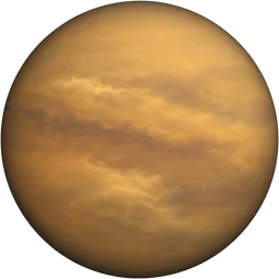 SpaceTitan5,150 kmTitan is a natural satellite of Saturn, with a thick nitrogen-rich atmosphere and surface lakes of hydrocarbons.
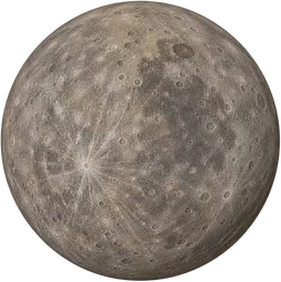 SpaceMercury4,879 kmMercury is a rocky planet orbiting closest to the Sun in the Solar System.
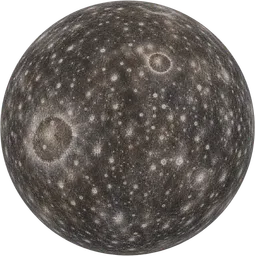 SpaceCallisto4,821 kmCallisto is a natural satellite of Jupiter, with a heavily cratered icy surface.
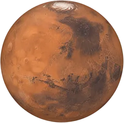 SpaceMars6,779 kmMars is a rocky planet orbiting the Sun, with a reddish surface due to iron oxide.PlacesYellow River5,464 kmThe Yellow River, or Huang He, is a major river in northern China, flowing from the Bayan Har Mountains to the Bohai Sea.